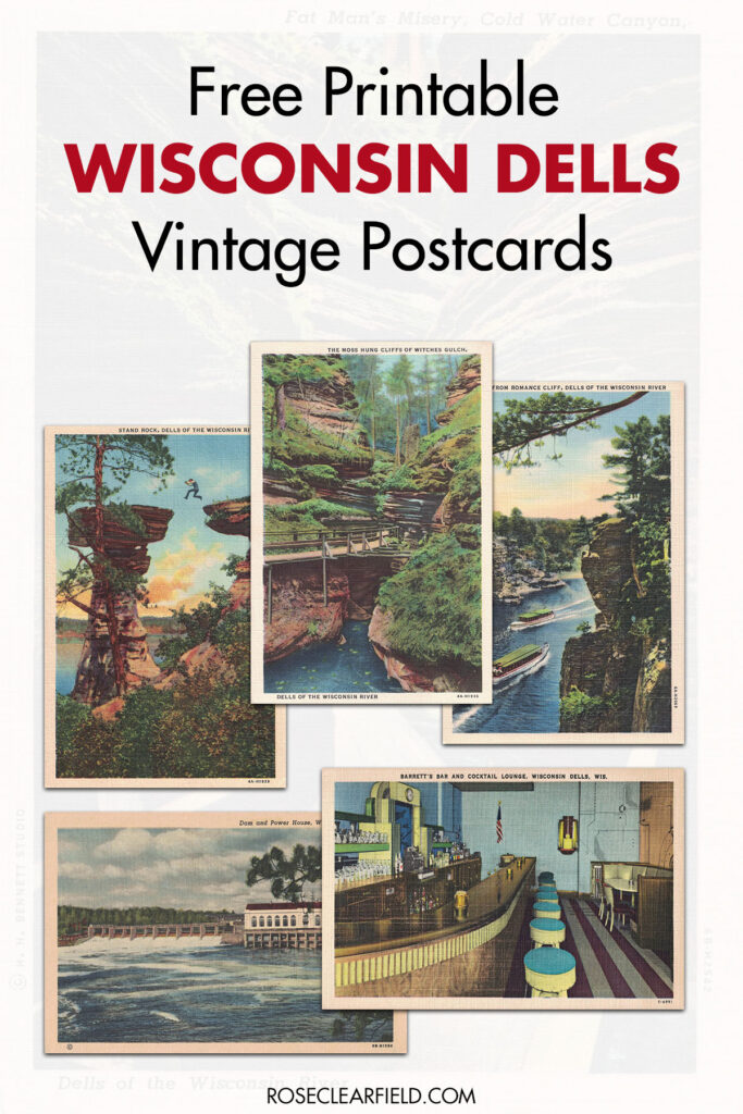
Free printable vintage Wisconsin Dells postcards are perfect for home decor for Wisconsinites.
Earlier this year, I started releasing sets of free printable vintage postcards. St. Patrick’s Day, Easter, and birthday vintage postcard collections are now available. Free printable vintage Wisconsin Dells postcards is the first of many location-themed vintage postcard collections I’ll be releasing over the coming months. I absolutely love the aesthetic of vintage postcards from this era and am excited to share so many of them with you. The vintage Wisconsin Dells postcard collection features a staggering 47 postcards showcasing this beautiful area of the country.
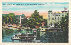
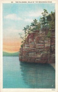
Much like Niagara Falls, the Wisconsin Dells is one of the oldest tourist spots in the United States, largely due to its stunning natural beauty. While it’s now primarily known for its numerous water parks, the Wisconsin Dells first drew and still draws numerous visitors every year for its breathtaking rock formations right on the Wisconsin River.
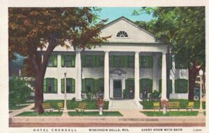
As such, many of the printable vintage Wisconsin Dells postcards I’m featuring here highlight the rock formations and boats on the Wisconsin River. You’ll see multiple iconic Wisconsin Dells locations, including Stand Rock, Witches’ Gulch, Cold Water Canyon, Sugar Bowl Island, Hornet’s Nest, and Visor Ledge. There are also a selection of postcards featuring historic Wisconsin Dells’ hotels and restaurants/cocktail lounges.
About the free printable vintage Wisconsin Dells postcards
You may download and print the postcards as many times as you like for personal use, including classroom use. You may use the postcards for limited runs (5,000 or less) of handmade physical items that you sell (i.e., coasters, collages, pillows). You are not authorized to sell the postcard images themselves as prints, only items you create with them.
Handmade physical items DOES NOT include made to order sites, such as Society6 and Zazzle. The sale of the download files themselves and of digital items using these images is also not allowed.
Additionally, please don’t distribute the download files. If friends, family, and co-workers are interested in their own postcards, please send them to this post where they can download their own files. Thank you!
I have a comprehensive guide about how to print and frame vintage postcards, which includes detailed information about the sizes and formats of the downloads I include here. If you still have questions after reading the guide, don’t hesitate to ask.
The low-resolution preview images in this post are intended solely for preview purposes. They are not suitable for printing. Use the download links to ensure you’re getting high-quality downloads in the size(s) you would like.
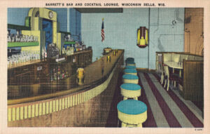
Barrett’s Bar and Cocktail Lounge
Barrett’s Bar and Cocktail Lounge boasted being a quiet place to meet your friends where you could relax in the air-conditioning.
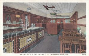
There is very little information online about Buckley’s Restaurant. Judging by the age of the postcards of Buckley’s, it dates back to the early 1900’s or even earlier.
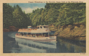
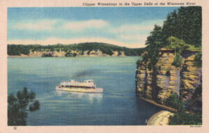
The Clipper Winnebago is a sternwheel excursion boat. The Clipper Winnebago was built in 1924 at Dubuque Boat and Boilers in Dubuque, Iowa with the engines built in 1920 at the Iowa Iron Works in Dubuque. It was assembled in the Dells. The Clipper Winnebago ran until 1948 when it was converted to a diesel-powered motor launch and renamed. Captains Oliver Reese and Arnold Priester ran the Clipper Winnebago. [Source]
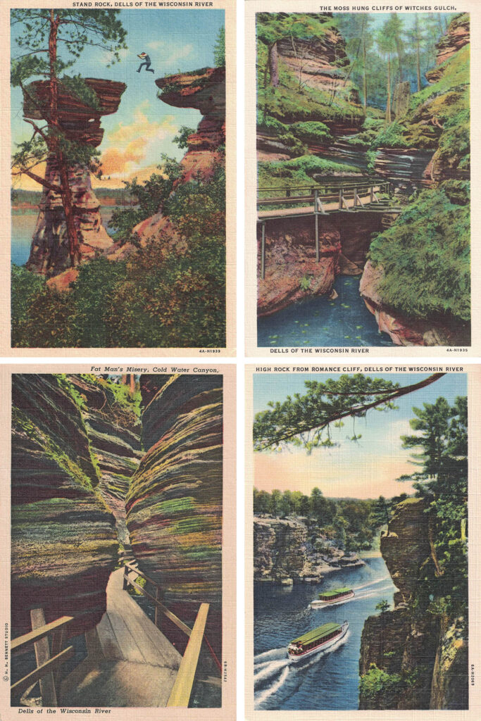
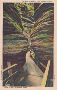
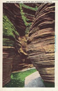
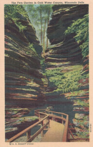
The Cold Water Canyon is a truly romantic spot in the Wisconsin Dells with very high rock walls and a very narrow passageway between them. Cold water springs feed a stream trailing along the rocky floor of the canyon. The narrowest point in Cold Water Canyon is called Fat Man’s Misery.
The Wisconsin Dells is home to 27 species of ferns. Some of the larger ones grow in vast beds beneath the forest trees. Many of the smaller varieties cling to crevices of the rock in the cool, moist canyons, including Cold Water Canyon.
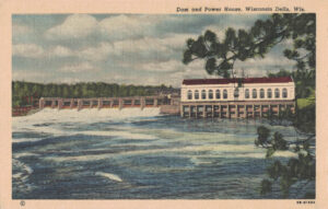
The dam and power house of the Wisconsin Power and Light Company separates the Upper and Lower Dells of the Wisconsin River. Over one hundred years old, the Dam is integral to the entire Wisconsin Dells area.
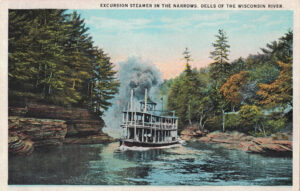
An excursion steamer navigating its way through the Narrows in the Wisconsin River. The Narrows is aptly named, as it’s one of the narrowest sections of the river.
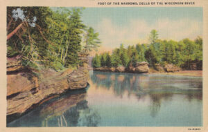
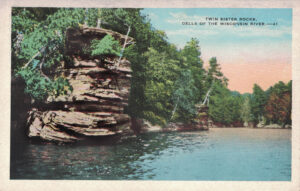
The Foot of the Narrows is a half-mile section of the Wisconsin River that gets very narrow. At the right, you see the cliff at Chapel Gorge. On the left, you see one of the Twin Sisters.
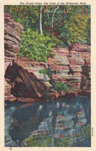
The Grand Piano is a tilted rock in the Lower Dells that resembles a partly overturned grand piano. You’re able to see the Grand Piano rock formation during the Lower Dells boat tour.
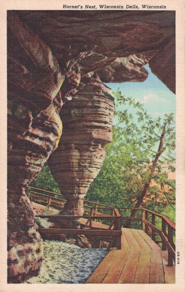
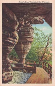
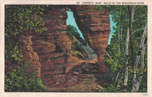
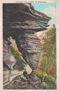
The Hornet’s Nest rock formation gets its name from its shape and general appearance. It serves as a pillar in front of a natural portico. The rock was washed out in prehistoric times, leaving behind a flat roof overhead with the Hornet’s Nest as its principal support.
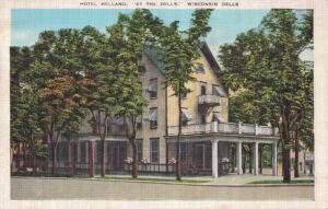
Hotel Helland was right in the heart of the Dells for easy access to dining, entertainment, and scenic views. The rooms included a private bath, garage, and free adjoining car parking. At the time of the postcard printing, the rates were advertised as $1.25 to $2.50 per person.
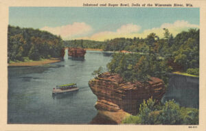
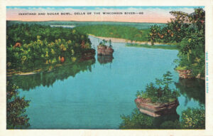
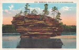
Inkstand and Sugar Bowl are two of the four rocky islands on the Wisconsin River in the Wisconsin Dells. Sugar Bowl is the larger of the two islands. The Grotto Rocks are located nearby with various large grottos extending several feet into the heart of the rock.
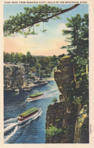
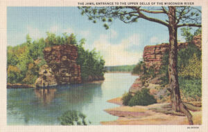
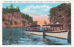
The Jaws are the entrance to the Upper Dells of the Wisconsin River. In both of these images of the Jaws, you see Romance Cliff on the left and High Rock on the right. The second image features two boats, “Black Hawk” and “Virginia,” about the pass through the Jaws.
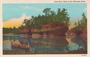
Lone Rock is the largest rock island in the Lower Dells. It is the farthest downstream and marks the end of the Lower Dells boat tour. There is a cave in Lone Rock extending the full length of the island.
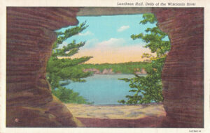
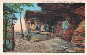
Luncheon Hall is one of several interesting rock formations along the section of the Wisconsin River near Stand Rock. It is defined by its prominent rock roof, which is supported at the river end by the solid sandstone.
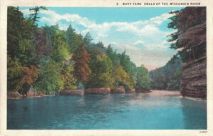
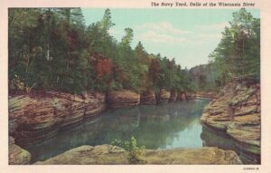
The Navy Yard is a stretch of rock formations on the Wisconsin River that resembles a fleet of boats at anchor, their prows projecting into the stream.
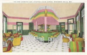
Designed after the famous Hiawatha Train, the New Hiawatha Bar at Stanton’s Palm garden featured an adjoining cocktail lounge and palm garden. They proudly served Schlitz beer and Billy Barter ginger ale.
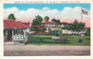
When the Spring Hill De Luxe Bungalows opened, they were one of the first hotels in the area to offer a suite of rooms with a private bath. Such privacy and comfort had not been available previously. The Bungalows also featured breakfast rooms and garage service.
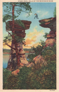
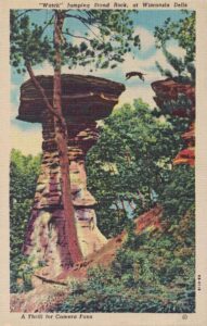
When you tour Stand Rock today as part of the Upper Dells boat tour, you get to see “Watch” the dog leap the chasm, which makes for a great photo opportunity. “Watch” is pictured in the second postcard here of Stand Rock.
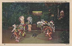
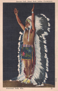
I have a couple of vintage postcards featuring the Sioux Indian tribe performing Stand Rock Indian ceremonials: Sunrise Call and Dog Feast Dance. The Dog Feast Dance was performed nightly at Stand Rock to commemorate the vital role the Indians’ hunting dogs played during the winter of the great famine.
The Twin Sisters Rocks are among the many stunning rock formations in the Wisconsin Dells area. These particular formations are located right near the Foot of the Narrows on the Wisconsin River.
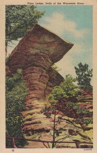
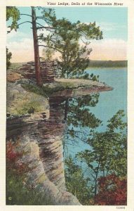
Visor Ledge is another iconic Wisconsin Dells rock formation in the Dells of the Wisconsin River. It gets its name from its shape, which resembles the square visor of a Civil War soldier’s cap.
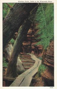
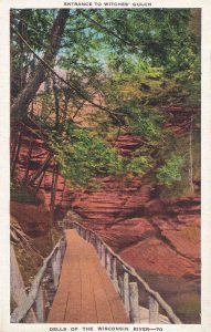
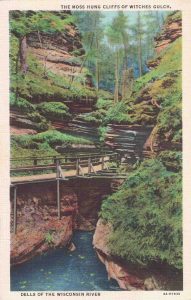
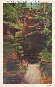
Witches Gulch is a narrow canyon in the Dells of the Wisconsin River. The spectacular walk is filled with fern glens, shadowy passages, and hidden whirlpool chambers. Arguably, it’s one of the most beautiful areas in the Wisconsin Dells, if not, in the entire state of Wisconsin.
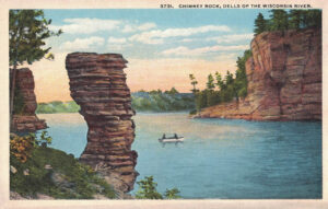
As of 2016, Witches Gulch is not accessible by land. If you’re interested in visiting Witches Gulch, you have to take the Upper Dells boat tour or travel there by water in your own boat. The Upper Dells boat tour also includes Stand Rock, Chimney Rock, Romance Cliff, and Blackhawk’s Profile.
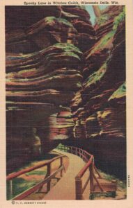
Spooky Lane gets its name from the combination of the strangeness of the rock formations, murmuring of the brook, and dim light falling through the green leaves. The aesthetic is weird and beautiful.
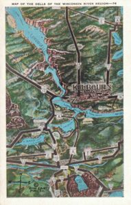
Finally, I’m ending with a hand-illustrated map of the Dells of The Wisconsin River region, which spans Devil’s Lake in the south to the Upper Dells in the north.
I have a comprehensive guide explaining the various download sizes I offer for my vintage postcards. It will help you select the best sizes for framing and DIY purposes. If you have any questions, don’t hesitate to ask!
Pin this post for easy access to the free printable vintage Wisconsin Dells postcards later!
Rose is a former teacher, now lifestyle blogger and online content creator. She's also a hobbyist photographer and amateur vintage collector. She's a mom living in southeast Wisconsin, sharing adoption resources, free printables, parenting tips, DIY projects, seasonal/holiday inspiration, and family-friendly recipes. Learn more about me.